Free sample lesson · The Great Mental Models Volume 1
Map vs. Territory
Have you ever followed GPS directions that led you to the wrong place?
Lesson 1 of the Wondering course The Great Mental Models Volume 1
The Map Is Not the Territory
Have you ever followed GPS directions that led you to the wrong place?
The GPS gave you a map: a simplified picture of the roads. The actual streets, closures, and construction are the territory.
- Map
- Territory
When the two disagree, the territory wins. Every time.
This lesson is about that gap. Maps, models, and data help us think, but they are never the same as the reality they describe.
Every Map Leaves Things Out
A map is useful because it leaves things out.
Imagine a map that was 100% accurate. It would include every tree, pebble, and crack in the road.
To hold all that detail, it would have to be the size of the territory itself. That makes it useless.
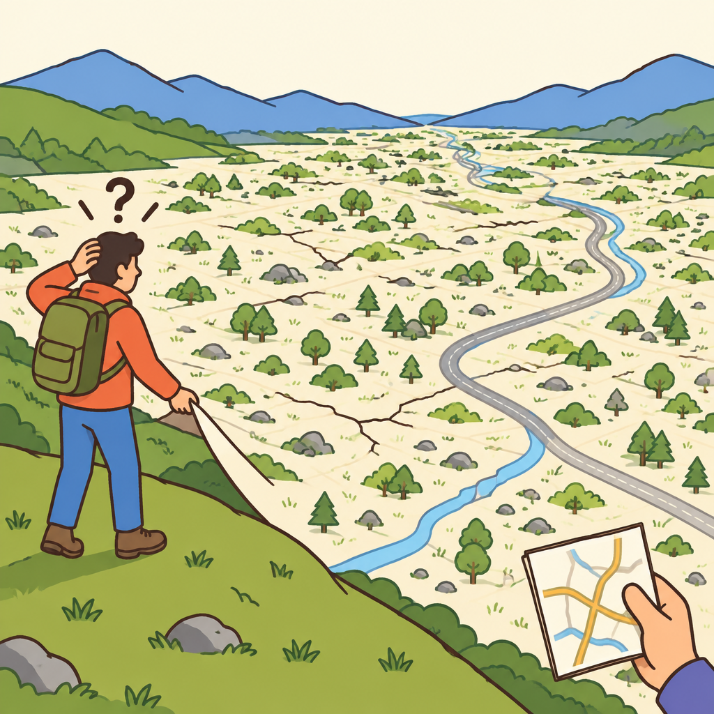
Notice how a map with every tree and pebble covers the whole landscape, so it can no longer help anyone find their way.
So every model, theory, or representation must reduce reality. Every map is incomplete by design.
Maps Are Everywhere
Maps are not only paper or GPS screens.
A mental model is a map in your head of how something works. A theory is a map of how the world behaves.
Metrics and dashboards are maps of how a business is doing.
- Maps: Simplified representations of reality
- GPS directions: A picture of the roads
- Mental models: How something works, in your head
- Theories: How the world behaves
- Metrics: How a business is doing
Each one simplifies. Each one leaves things out. And each one can drift away from reality without warning.
Where the Danger Lies
Simplifying is not the problem. Confusing the map with the territory is.
When we treat a representation as reality, we stop checking it. We make decisions based on incomplete or outdated information.
- Trust the map: You treat the representation as reality.
- Stop checking: You no longer compare it with what is actually there.
- Act on gaps: You decide using incomplete or outdated information.
- Costly error: Reality differs, like driving toward a closed road.
The map says the road is open. The road is closed. You drive anyway.
That is how a useful tool turns into a costly error in judgment.
Bezos Picks Up the Phone
Early in Amazon's history, Jeff Bezos sat in a weekly business review.
The customer service metrics showed wait times under sixty seconds, within expectations. Yet customers were complaining about long waits.
Rather than trusting the data, Bezos called Amazon's customer service number himself.
He waited on hold for over ten minutes. The metrics were wrong because of a problem with how the data was being collected.
- Wait time in the metrics: The map: within expectations.
- Bezos's wait on the phone: The territory: what customers actually lived.
The gap came from how the data was being collected.
Touch the Territory
Bezos's move has a name: touching the territory.
It means directly experiencing reality instead of relying only on abstractions or data. You call the line, visit the site, or use the product.
Then compare what you saw with what your model said.
- Use your map: Rely on the model or data to plan.
- Touch the territory: Call, visit, or use it yourself.
- Compare: Check what you saw against what the model said.
- Update the map: Fix the model where reality differs.
If they differ, update the map. Then keep checking, because maps go out of date.
Putting It to Work
You will spot this idea in your own work once you look for it.
First, every map is a reduction, so it is always incomplete.
Second, verify your maps by touching the territory whenever you can.
When a number looks fine but people complain, trust the complaint enough to go see for yourself.
Check yourself
Every model or theory is a _____ of the reality it describes
- simplification
- complete copy
Answer: simplification
Maps, models, and theories must leave out details to be usable. That makes every one of them a simplification, never an exact copy.
The _____ is a simplified representation, such as a model or metric, while the _____ is the actual reality it stands for.
Answer: The map is a simplified representation, such as a model or metric, while the territory is the actual reality it stands for.
The map is any abstraction: a model, theory, dashboard, or chart. The territory is the real thing being described. The two are never identical.
What is the main danger of treating a model as if it were reality itself?
- Decisions get based on incomplete or outdated information
- The model becomes too detailed to understand
- Reality starts changing to match the model
- Simple models stop being useful at all
Answer: Decisions get based on incomplete or outdated information
Models leave out details and can become outdated. If you forget this and treat the model as reality, you make decisions on incomplete or wrong information. Models are still useful, and simplifying is unavoidable. The risk comes from confusing the model with reality.
Keep going
This is lesson 1 of 25 in The Great Mental Models Volume 1. Next up:
- Update Maps
- Knowing Your Circle of Competence
- Expanding Circle
- First Principles
- First Principles Application
Wondering turns any topic into short lessons you can read, watch, or listen to, with practice questions and an AI tutor.