Free sample lesson · LiDAR Fundamentals for Autonomous Vehicles
Light Pulses
How can a beam of light tell a car exactly where a wall is?
Lesson 1 of the Wondering course LiDAR Fundamentals for Autonomous Vehicles
How Light Measures Distance
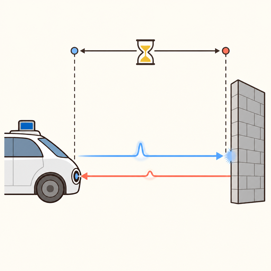
How can a vehicle know where a wall is? It can send out a brief light pulse and listen for the reflection.
The pulse travels to the wall, bounces back, and reaches a sensor. The vehicle measures the time between sending and receiving it.
This method is called Time of Flight, or ToF. Because light travels at a known speed, a longer return time means a farther object. ToF gives an autonomous vehicle a direct way to estimate distance.
The Return Trip Matters
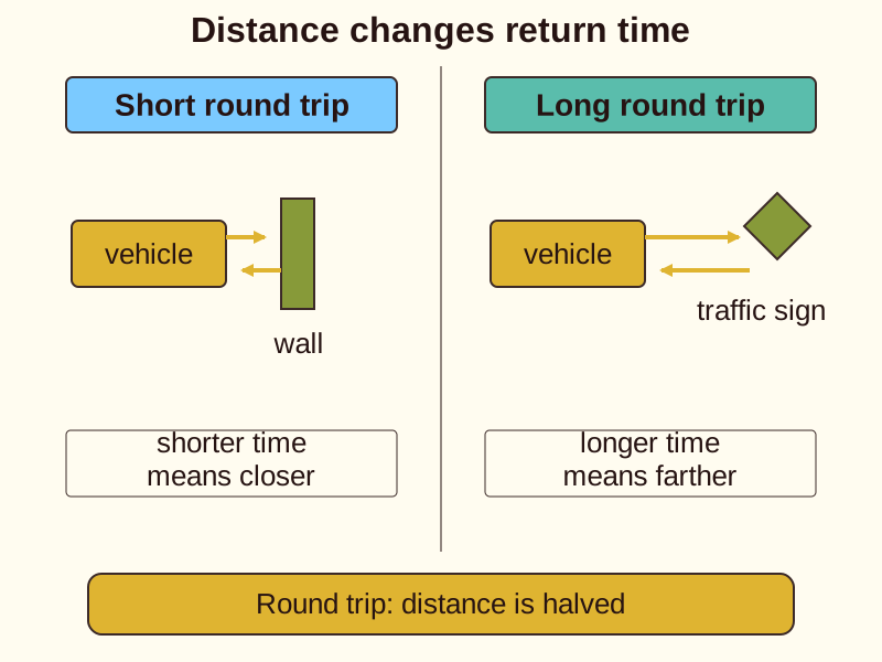
A light pulse makes a round trip: from the vehicle to an object, then back to the sensor.
The computer uses the measured time and the constant speed of light to calculate the total travel distance. It then accounts for the two-way journey to estimate the object’s distance.
For example, a nearby wall returns its pulse quickly. A traffic sign farther away returns it later. Shorter time means closer; longer time means farther.
What LiDAR Does
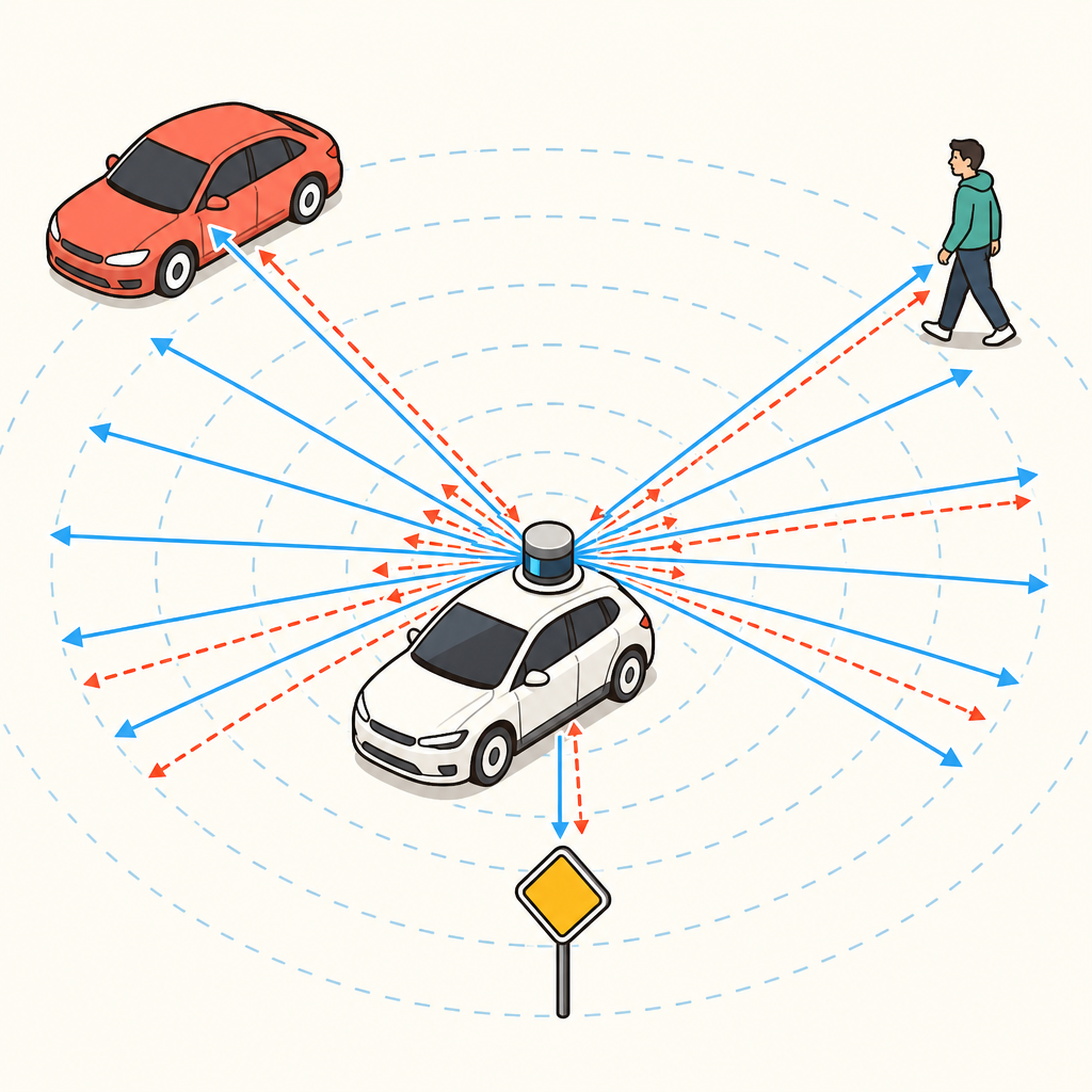
LiDAR means Light Detection and Ranging. It uses pulsed laser light to measure ranges to objects around a vehicle.
A LiDAR system rapidly emits infrared laser pulses, often thousands of times per second. Each pulse travels through the air and may bounce from a car, pedestrian, or traffic sign.
A sensitive detector receives the returning light. The system repeats this process across many directions, collecting distance measurements from the surrounding area.
From Pulses to a Map
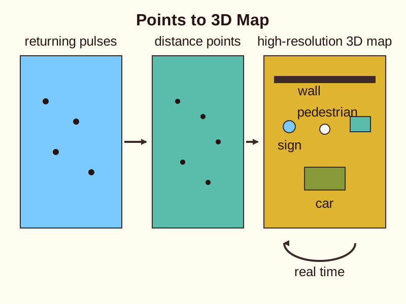
Each returning pulse provides a distance to one point where light bounced back. Many points together describe nearby objects and surfaces.
The vehicle computer combines these measurements into a high-resolution 3D map of its surroundings. This map updates in real time as the vehicle moves.
The map can show where a wall, car, pedestrian, or traffic sign is located. For an autonomous vehicle, these measured distances support awareness of nearby space and possible obstacles.
Why Light Pulses Help
LiDAR provides its own light source, so it can measure distance in various lighting conditions. It does not need to rely only on light already present in the environment.
LiDAR also offers strong depth accuracy for short- to medium-range spatial awareness. This makes it useful when an autonomous vehicle needs clear information about nearby objects.
Remember the core chain: emit, reflect, detect, calculate. Time of Flight turns a tiny timing measurement into distance, and many distances become a 3D view.
- Emit: LiDAR sends out a pulsed laser light signal using its own light source.
- Reflect: The pulse travels through the air and reflects from a nearby object.
- Detect: A sensitive detector receives the returning light.
- Calculate: Time of Flight turns the timing measurement into distance.
- Map: Many measured distances combine into a 3D view for spatial awareness.
Check yourself
What does Time of Flight (ToF) measure?
- The time for light to travel to an object and return
- The brightness of light reflected by an object
Answer: The time for light to travel to an object and return
Time of Flight (ToF) measures how long a light pulse takes to travel to an object and return to the sensor. It does not measure the object's color or weight.
A distance-sensing cycle follows this sequence: _____ a light pulse, let it _____ from an object, _____ the returning light, and _____ the distance.
Answer: A distance-sensing cycle follows this sequence: emit a light pulse, let it reflect from an object, detect the returning light, and calculate the distance.
The sensing chain is emit, reflect, detect, calculate. The vehicle sends the pulse, the object reflects it, the sensor detects the return, and the computer calculates distance.
How can LiDAR help an autonomous vehicle build a 3D map?
- It combines many measured points around the vehicle
- It records only the vehicle's speed
Answer: It combines many measured points around the vehicle
LiDAR sends many pulsed laser measurements in different directions. Each returning pulse gives the distance to one point, and many points together form a 3D map.
Keep going
This is lesson 1 of 4 in LiDAR Fundamentals for Autonomous Vehicles. Next up:
- Sensor Components
- Point Clouds
- Object Detection
Wondering turns any topic into short lessons you can read, watch, or listen to, with practice questions and an AI tutor.